District Plan Hauraki Gulf Islands Section - Proposed 2006
(Notified version 2006)
Street index |
Planning maps |
Text |
Appendices |
Annexures |
Section 32 material |
Plan modifications |
Help |
Notified - Home |
Decision - Home
Help
Quick overview
There are now two
plans applying to the Hauraki Gulf Islands - the operative (1996) plan and the
proposed (2006) plan.
Both plans have three primary components:
- The written
text which contains the resource management issues, objectives,
policies and rules
- The planning
maps which indicate in graphic form the areas to which certain
rules in the written text and appendices apply
- The appendices which contain
additional limitations and information such as heritage sites,
designations and design guidelines.
The written text should be read as a whole so that the common themes of
the Plan and the relationship between the various chapters can be
understood. There is a significant amount of cross-referencing in the
text in order that repetition is avoided where possible. The most common
form of navigating this site is:
The proposed plan text is available in PDF and HTML formats. The HTML
version contains links within the parts of the text, links between the
parts of the text and links from Map 1 of each map in the map grid.
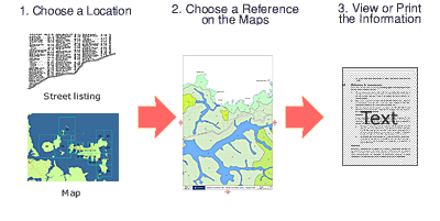
Finding your way around by maps
The
maps grid is detailed in the overview diagram.
Click the appropriate area to be linked to the appropriate planning map.
In the operative plan, the inner island maps contain all information on one map.
There are no maps available for the outer islands.
In the proposed plan, there are maps for both the inner and outer islands. The
maps for the outer islands have an aerial base, whereas the inner maps do not.
There are two maps for each area - one showing the land unit or settlement area
information which links to the text through the legend, and one showing
additional limitations which links to the text and/or appendices through the
sites. To reach the appendices this way hold the cursor over the selected site
and double click.
Finding your way around by street name
The
full Hauraki Gulf Islands' street index
will provide links to Planning Map 1 of the applicable map sheet.
Users already familiar with the plan
If you are looking for the quickest way around this Plan, use the
navigation
links at the top of the page to take you directly to the streets, maps,
text, appendices and annexures pages. We also would appreciate
any feedback you may have.
Why
are the map images slow to load over the internet?
The map images are fairly large (up to 790k) to show enough detail to make
them readable on a computer screen, helping users be able to identify
correct roads, properties and city features. The map quality
and readability was traded for size and loading speed, particularly for
people viewing this over an internet connection.
How do I view/print/save PDF files?
If you don't have Adobe Acrobat Reader, go to Adobe's website
for installation instructions. If
you can't view the pdf files and have Acrobat Reader installed, you may
need to configure your browser.
To save a PDF file to your local
system - for PC's, right click and choose 'Save Target As'. For Mac's,
click and hold the file link, then choose 'Save File As'.
Can I copy/paste text and
graphics from the PDF files?
Yes, you can copy and paste individual text, multiple columns
of text and graphic from the PDF files into most popular software applications,
such as Microsoft Word and many others.
For a full easy to follow description, look in the Help when you
are using Adobe Acrobat Reader.
What are those 'KB' numbers next to the
text?
The 'KB' numbers refer to the file size of the associated Adobe Acrobat
'PDF' file. The 'KB' refers to the number of bytes in thousands. Use this
figure to determine how large a document is when you
need to download it from the internet. The actual length of time needed
to download the files will vary depending on the speed of your computer, your
modem, and your internet connection.
Estimated download times:
| File Size |
Internet Connection |
Time to download |
| 500KB |
33k modem |
2 min, 2 sec |
| 500KB |
56k modem |
1 min, 9 sec |
| 500KB |
128k connection |
0 min, 32 sec |
| 500KB |
256k connection |
0 min, 16 sec |
| 1,000KB |
33k modem |
4 min, 4 sec |
| 1,000KB |
56k modem |
2 min, 27 sec |
| 1,000KB |
128k connection |
1 min, 36 sec |
| 1,000KB |
256k connection |
0 min, 48 sec |
My browser stops responding when I try to view some
PDF filesA few of the larger PDF files put high resource demands on your
system. We recommend upgrading to the latest version 7.0 of Adobe Acrobat. Check
the estimated download time guide above.
Contacting Auckland City
If you require any further information, please
- telephone 379 2020 for advice or to make an appointment
- email
hgiplan@aucklandcity.govt.nz
- visit us at Level 11, Civic Administration Building, 1 Greys
Avenue, Auckland Central
- write to: City Planning, Auckland City Council, Private Bag 92516,
Wellesley Street, Auckland.
Reviewed January 2009