Plans, policies and reports
District Plan Hauraki Gulf Islands Section - Proposed 2006
(Notified version 2006)
Street index |
Planning maps |
Text |
Appendices |
Annexures |
Section 32 material |
Plan modifications |
Help |
Notified - Home |
Decision - Home
Planning maps
Click the desired location to go to the Planning maps.
Explanatory notes here.
Use these links to highlight different significant sites on the maps:
archaeological sites,
buildings,
ecological areas,
geological sites and
scheduled trees.
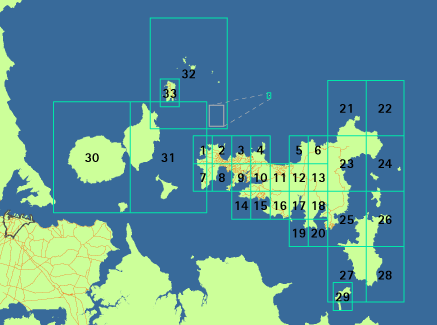
Inner gulf
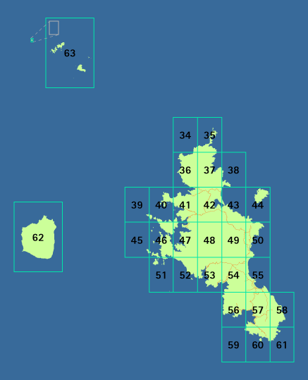
Outer gulf
Explanatory notes
- This set of
Planning maps relates to the Proposed Hauraki Gulf Islands Section of the Auckland
City District Plan.
- The Planning maps show the location of land units, settlement areas,
scheduled heritage items and other constraints on land development.
- North Point is vertical.
- The property boundaries shown on the Planning maps are indicative only.
The planning maps for the Hauraki Gulf islands have been divided into maps
for the inner islands and maps for the outer islands. In total there are 63 map
sheets.
Each sheet has been further divided into map 1 and map 2. Map 1 identifies
the location of land units, settlement areas (Great Barrier only) and
significant ridgeline areas. Map 2 contains information about designated land,
scheduled heritage items, natural hazard areas, other additional limitations and
roading classifications. It is important to look at both map 1 and 2 for any
site.
Reviewed March 2009