District Plan Hauraki Gulf Islands Section - Proposed 2006
(Notified version 2006)
Street index |
Planning maps |
Text |
Appendices |
Annexures |
Section 32 material |
Plan modifications |
Help |
Notified - Home |
Decision - Home
Part 3 Strategic management areas
3.1 Introduction
3.2 Great Barrier strategic management area
3.3 Waiheke strategic management area
3.4 Other islands' strategic management area
3.1 Introduction
Strategic management areas are a framework to provide
a strategic direction for resource management in the Hauraki Gulf. When
combined with the more localised directions provided by the settlement
areas and land units, a comprehensive and integrated approach to resource
management is achieved.
Different islands have their own character and identity
so three strategic management areas are assigned:
- Great Barrier.
- Waiheke.
- Other islands.
This part of the Plan addresses each of the three strategic
management areas, identifying the issues that need to be addressed and
the objectives and policies that are to be achieved at a strategic level.
This is followed by a strategy that outlines the tools used in the Plan
to address the issues and achieve the objectives and policies.
3.2 Great Barrier
strategic management area
3.2.1 Introduction
Great Barrier lies on the outer edge of the Hauraki
Gulf and with an area of 28500ha is the largest island within the Hauraki
Gulf.
Great Barrier has a rugged, natural landscape that is
recognised as being important on both a regional and national level.
There are also a range of natural features such as wetlands, forest
and bush areas, wildlife habitats and varied coastal environments. A
significant proportion of the landscape and natural features are protected
from development as 68 per cent of the island is in the ownership of
the Department of Conservation.
The heritage value of the island to both Maori and European
is also high. Ngati Rehua, hapu of Ngati Wai, can trace their association
with Great Barrier (Aotea) back over many centuries; evidence of this
can be seen in the numerous archaeological sites including fortified
pa and agricultural, settlement and stone working sites. Large areas
of land around Katherine Bay at the northern end of the island remain
in Maori ownership.
Early European settlement was based around whaling,
mining of copper, gold and silver ore and the milling of kauri and other
trees. There are still a number of families on the island today that
can trace their roots back to these early days of European settlement.
Additional information about the history of human settlement
on Great Barrier can be found in annexure 1 - The history of human settlement
of the islands.
The areas of settlement on the island are at Tryphena,
Claris, Port Fitzroy, Okiwi, Okupu, Whangaparapara, Medlands, Awana
and Aotea (encompassing Motairehe and Kaoa). These settlements contain
residential development and, in some instances provide low scale commercial
activities. While built development is apparent in these locations,
the sheer scale and rugged nature of the landscape behind the settlements
means that the natural character of the island is the dominant and defining
feature.
The population of the island has been in decline in
recent years, to a point where the permanent resident population in
2006 is in the order of 800 people. Despite this decline, the community
is valued for its diversity, independence, resourcefulness and for people's
care for one another. These characteristics are largely the result of
the rugged landscape, the lack of reticulated services and the relative
isolation of the island.
In terms of the economy of the island, agriculture and
horticulture activities have a long history on Great Barrier and consequently
make a significant contribution to the self-sufficient character of
the island. Tourism, transport and accommodation activities have experienced
significant growth in recent times and are expected to be a key component
of the island economy into the future.
Air and sea services provide a vital link between the
island community and the remainder of the Auckland region, although
these services vary in their frequency.
3.2.2 Resource
management issues
The significant resource management issues which need
to be addressed in the Plan are:
- How to protect the natural landscape
character and natural features of the island.
- How to assist economic growth on
the island, particularly growth in the tourism industry.
- How to provide for conservation
and recreation activities on land owned by the Department of Conservation
and other agencies.
- How to recognise the particular
character and identity of the island community.
- How to encourage the further development
of essential infrastructure on the island such as wharves, airports,
telecommunications equipment, quarries and shared infrastructure such
as water and wastewater systems and power generation.
- How to recognise the relationship
between Ngati Rehua and their ancestral lands, water, sites, waahi tapu
and other taonga.
3.2.3 Objective
To provide for the economic, social and cultural wellbeing
of the Great Barrier community while ensuring the protection of the
natural landscape character and the natural features of the island.
Policies
- By providing for growth and development
to occur within, and in some instances around, existing settlements.
- By limiting the level of development
that can occur outside of the settlement areas so that the natural landscape
and natural features of the island are protected.
- By ensuring that all development
is of an appropriate scale, form and location.
- By protecting the natural landscape
character of the island, particularly with respect to its unbroken,
expansive and dominating nature.
- By protecting natural features,
such as wetland systems, indigenous vegetation and wildlife habitats
from the adverse effects of use and development.
- By facilitating the use and development
of land for conservation, recreation and community purposes.
- By providing for the appropriate
development of essential infrastructure such as airports, roads, wharves
and quarries.
- By providing for the use of ancestral
lands by Ngati Rehua and acknowledging the relationship between Ngati
Rehua and water, sites, waahi tapu and other taonga.
3.2.4 Resource
management strategy
The resource management issues, objectives and policies
for Great Barrier are interrelated. For example, economic growth through
tourism is reliant on the protection and development of key infrastructure
such as wharves and the protection of the landscape and amenity of the
island. Consequently, the issues need to be addressed and the objectives
and policies achieved in a manner that benefits the long term future
of the island as a whole. This is achieved through:
- Settlement plans promote growth and development
in and around the settlement areas on Great Barrier. Concentrating growth
and development in these areas has the following benefits:
- Providing identified areas for commercial
and retail activities to establish and obtain the benefits of being
located near other similar activities.
- Protecting the surrounding landscape
and natural features from inappropriate development.
- Encouraging the use of existing
infrastructure and maximising the possibilities for shared infrastructure
development due to the concentration of residents, visitors and activities.
- Ensuring that agricultural and horticultural
activities can continue to contribute to the lifestyle and economy of
the island.
- Providing for the appropriate use
and development of the ancestral lands of Ngati Rehua.
- Addressing social needs of the community
by providing places for people to meet and socialise.
- Development controls ensure that
development inside and outside of settlement areas does not have an
adverse effect on the natural character of the landscape and the natural
features of the island.
- Landform based land units ensure
that development occurring outside of the settlement areas takes account
of the natural environment in which it is located. In particular, these
land unit provisions ensure that activities and buildings are of an
intensity, scale, form and location which will protect the natural landscape
and natural features of the area.
- Activity based land units to provide
for wharf, conservation, recreation and community activities. This approach
recognises that these activities have significant benefits for the community
and the identity and economy of the island.
- Council designations protect essential
infrastructure such as Claris and Okiwi airports and Claris landfill.
These designations recognise that this infrastructure is important for
both economic and social reasons and consequently needs to be protected
and developed appropriately.
3.3 Waiheke strategic
management area
3.3.1 Introduction
At 9324ha, Waiheke is the second largest island in the
Hauraki Gulf. It is 26km long and 19km across at its widest point and
has rolling hills that reach 230m in height.
The Maori history of Waiheke follows the classical pattern
of one tribe conquering and ousting another. Evidence of this history
can be seen in the archaeological sites scattered across the island,
including fortified pa and agricultural, settlement and stone working
sites.
European settlement of the island was farming based,
with a few landowners farming large tracts of land obtained from Maori.
In the early 20th century, landowners on the western end of the island
progressively sold off parts of their farms for 'village' style development.
Information about the history of human settlement on
Waiheke can be found in annexure 1 - The history of human settlement
of the islands.
Western and eastern Waiheke
Waiheke has developed into two areas with different
planning characteristics:
- Western Waiheke
Western Waiheke (refer figure 3.1 - Western and eastern Waiheke) is
characterised by a series of villages such as Oneroa, Blackpool, Surfdale,
Ostend, Onetangi and Rocky Bay. These villages contain most of the island's
population and are the centres of economic and social activity on the
island. Interspersed between these villages are small areas of land
with a rural character and amenity. Also within western Waiheke, peninsulas
such as Te Whau, Church Bay, Park Point and Owhanake have been developed
for rural-residential living, often with large areas of regenerating
bush to mitigate the adverse effects of built development.
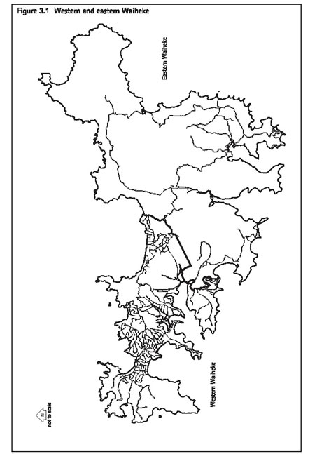
- Eastern Waiheke
Eastern Waiheke (refer figure 3.1) is characterised by a working landscape
of large scale, agricultural and horticultural activities. Also within
eastern Waiheke are a number of important natural features such as large
areas of indigenous vegetation, undeveloped beaches and significant
ecological areas. Intensive development is limited to a very small area
on the southeastern coast of the island at Orapiu.
This pattern of development and the natural features
on the island, such as, white sandy beaches and large areas of indigenous
vegetation means that the Waiheke landscape has high visual amenity
value. In some areas, particularly on the eastern end of the island,
the landscape values are so high that they are recognised as being important
on a regional and national level.
The population of the island has increased in recent
years to the point where the permanent population in 2006 is estimated
to be in the order of 8000 people. The economy of the island is based
around a variety of activities including agriculture and horticulture,
retail and commercial activities, food and wine produced locally. Tourism
is also a key factor in the economy and is largely based on the safe
swimming beaches, scenic walking trails and visits to the many vineyards,
cafes and restaurants.
Access to the island is primarily via sea services.
Passenger ferries operate regularly from the central business district
to Matiatia while passenger and freight services run from Half Moon
Bay to Kennedy's Point. These services provide a vital link between
the island community and the remainder of the Auckland region.
3.3.2 Essentially
Waiheke
Essentially Waiheke - A Village and Rural Communities
Strategy is a non-statutory strategic document which sets out a community
approved framework for Waiheke's development. It was adopted by council
in 2000 after extensive consultation with the Waiheke community.
The five central principles of Essentially Waiheke are:
- Principles of environmental protection.
- Principles of economic development and
employment.
- Principles of strong communities.
- Principles to protect and enhance Waiheke's
character.
- Principles of location.
These five central principles are reflected within the
Waiheke strategic management area and within other parts of the Plan.
3.3.3 Resource
management issues
The significant resource management issues which need
to be addressed in the Plan are:
- How to protect the landscape character
and natural features of the island.
- How to assist economic growth, particularly
growth in the tourism industry.
- How to protect the range of living
environments available on the island.
- How to provide for recreation and
conservation activities on land in public ownership or owned by other
agencies such as the Royal Forest and Bird Protection Society.
- How to maintain the large scale,
rural character of eastern end of the island and the 'village' style
of development on the western end of the island.
- How to recognise the particular
character and identity of the community.
- How to provide for the further development
of essential infrastructure on the island.
- How to ensure that there is sufficient
land available for residential use.
- How to recognise the relationship
between Ngati Paoa and their ancestral lands, water, sites, waahi tapu
and other taonga.
3.3.4 Objective
To provide for the economic, social and cultural wellbeing
of the Waiheke community while ensuring the protection of the landscape
character and the natural features of the island.
Policies
- By providing for 'village' style activities
and development to occur in western Waiheke, while ensuring that the
existing pattern of development and the visual amenity of the area is
maintained.
- By providing for large scale, rural
activities to occur in eastern Waiheke, while ensuring that such development
does not detract from the natural landscape and natural features of
the island.
- By ensuring that 'village' style
activities and development on western Waiheke do not spread into or
occur within eastern Waiheke so that the distinct character of each
end of the island is maintained.
- By protecting the landscape character
of the island, particularly the rural landscapes and landscapes with
regenerating bush.
- By protecting natural features,
such as wetland systems, indigenous vegetation and wildlife habitats.
- By facilitating the use and development
of land for conservation, recreation and community purposes.
- By providing for the appropriate
development of essential infrastructure.
- By providing for the relationship
between Ngati Paoa and water, sites, waahi tapu and other taonga.
3.3.5 Resource
management strategy
The resource management issues, objectives and policies
for Waiheke are interrelated. For example, economic growth through tourism
is reliant on the protection and development of key infrastructure such
as wharves and the protection of the landscape and amenity of the island.
Consequently the issues need to be addressed and the
objectives and policies achieved in a manner that benefits the long
term future of the island as a whole. This is achieved through:
- Area based land units apply in locations
such as Oneroa, Ostend, Matiatia and Rangihoua Park. This is because
these areas require a specific and comprehensive approach to provide
for development and to ensure that such development is of an appropriate
nature, scale and form.
- Landform based land units apply
in eastern Waiheke to ensure that the large scale rural activities continue
to occur in this end of the island and to ensure activities and buildings
are of an intensity, scale, form and location which will protect the
natural landscape and natural features of the area.
- Activity based land units apply
in western Waiheke to facilitate a range of activities including retail,
industrial, visitor facilities and recreation and community purposes.
- Development controls ensure that
development does not have an adverse effect on the character and visual
amenity of the landscape and the natural features of the island.
- Council designations protect essential
infrastructure such as the Owhanake Wastewater Treatment Plant. These
designations recognise that this infrastructure is important for both
economic and social reasons and consequently needs to be protected and
developed appropriately.
3.4 Other islands'
strategic management area
3.4.1 Introduction
The other islands' strategic management area relates
to all islands within the jurisdiction of Auckland City (refer figure 1.1: geographic areas) aside from Waiheke and Great Barrier. The most
well known of these islands are Rangitoto, Browns, Motutapu, Rotoroa,
Motuihe, Ponui, Rakino and Pakatoa but there are also many other islands
such as Little Barrier, Pakihi, Karamuramu, the Noises and the Mokohinau
group. In total there are 63 other islands.
Despite their number and differing characteristics,
the other islands generally fall into two categories:
- Islands used for conservation or recreation
activities or both
Examples of these islands are Little Barrier, which is a flora and fauna
reserve with limited public access, and Motutapu which is used in part
for outdoor recreation activities. These islands are generally in public
or Maori ownership.
- Islands that have been developed
and used for particular activities
Examples of such islands are Pakatoa, which has been developed for visitor
accommodation purposes; Ponui which is farmed; Rotoroa which has been
used in the past by the Salvation Army for drug and alcohol rehabilitation
activities; and Rakino which has residential development. These islands
are generally in private ownership.
Because of their island character, coastal location
and natural environment values, many of the other islands contain landscapes
which are recognised as being regionally and nationally important.
3.4.2 Resource
management issues
The significant resource management issues which need
to be addressed in the Plan are:
- How to provide for conservation and recreation
purposes on land owned by the Department of Conservation and other agencies.
- How to protect the landscape character,
visual amenity and natural features of the other islands.
- How to provide for the variety of
activities that occur on the other islands.
- How to recognise the particular
character and identity of the communities living on the other islands.
- How to recognise the relationship
Ngati Rehua and Ngati Paoa have with their ancestral lands, water, sites,
waahi tapu and other taonga.
3.4.3 Objective
To provide for recreation, conservation and other activities
while ensuring the protection of the landscape character and the natural
features of the other islands.
Policies
- By protecting the landscape character
and natural features, such as wetland systems, indigenous vegetation
and wildlife habitats of the other islands.
- By providing for the use and development
of land for conservation and recreation activities.
- By providing for a range of activities
to occur where these activities are of an appropriate nature, scale,
form and location.
- By acknowledging the relationship
between Ngati Rehua and Ngati Paoa and their ancestral lands, water,
sites, waahi tapu and other taonga.
3.4.4 Resource
management strategy
As identified in the introduction above, the other islands
are divided into two categories:
- islands used for conservation or recreation
activities or both
- islands that have been developed and used
for particular activities.
In terms of these two categories, the following strategy
has been prepared:
- A conservation and recreation based land
unit (conservation) is applied. This land unit acknowledges that these
activities make a significant contribution to the character and identity
of the islands, and as such, specifically seeks to provide for these
activities.
- Island based land units apply to
Rotoroa, Pakatoa and the larger properties on Rakino. These land units
provide a specific and comprehensive approach for the particular activities
occurring on these islands while ensuring that the landscape character
and the natural features of these islands are protected.
- Landform based land units apply
to Ponui and Pahiki to provide for productive activities while ensuring
that such activities and the associated buildings are of an intensity,
scale, form and location that will protect the landscape character and
natural features of the island.
- An activity based land unit (commercial
6 (quarry)) has been adopted for Karamuramu in recognition that quarrying
is a well-established activity on this island that needs to be provided
for.